The Area
Located in north-eastern Italy in the province of Treviso, the site encompasses the hilly strip that extends eastward from the municipality of Vittorio Veneto, descending towards Conegliano. It includes a significant section of the controlled and guaranteed denomination of origin vineyard area where Conegliano Valdobbiadene Prosecco Superiore DOCG is produced.
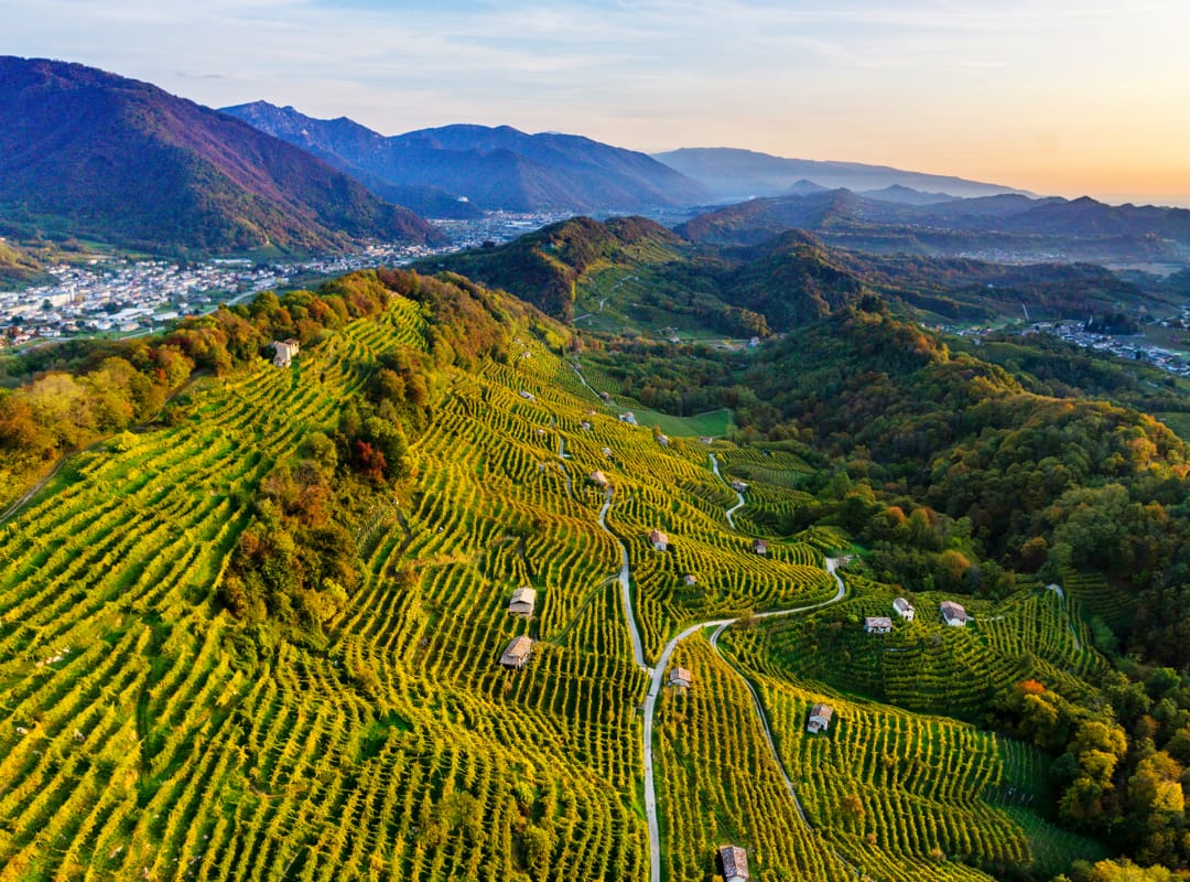
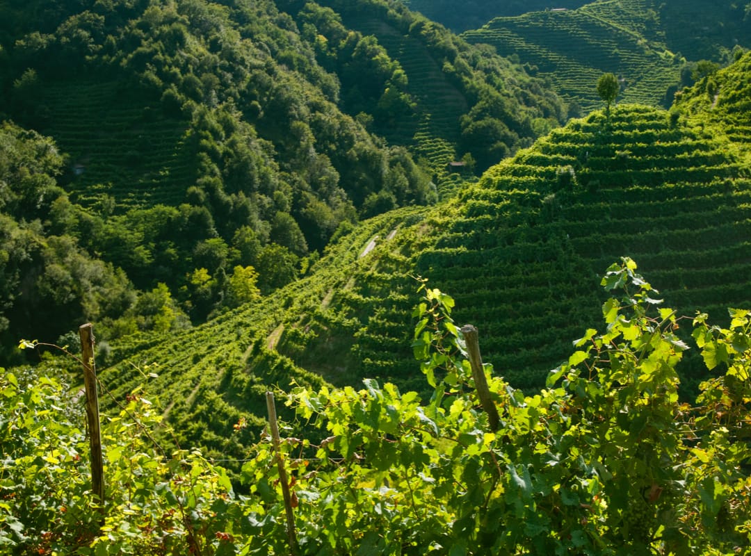
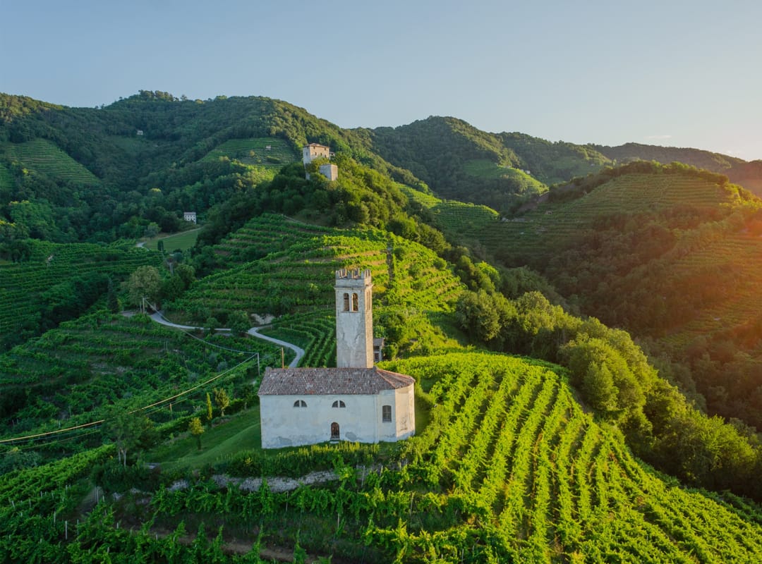
The landscape is characterised by hills, ciglioni – small plots of vines on narrow grassy terraces – forests, small villages and farmland. For centuries, this rough terrain has been shaped and adapted by man. Since the 17th century, the use of ciglioni has created a distinctive checkerboard landscape consisting of rows of vines parallel and vertical to the slopes. In the 19th century, the bellussera technique of vine-growing contributed to the aesthetic characteristics of the landscape.

The three zones
The site “The Prosecco Hills of Conegliano and Valdobbiadene”, a UNESCO World Heritage Site, is located in Veneto, in a small hilly area in the province of Treviso, where the positive interaction between man and the environment has created a unique cultural landscape.
1 Core Zone
2 Buffer zone
3 Commitment zone
Core zone
The core zone has an extension of 9,197.45 hectares. It does not correspond with administrative borders and includes the hilly territories falling within the municipalities of Valdobbiadene, Miane, Farra di Soligo, Pieve di Soligo, Follina, Cison di Valmarino, Refrontolo, San Pietro di Feletto, Revine lago, Tarzo, Vidor and Vittorio Veneto. The area represents the attributes of the rural landscape, through which the candidacy and then the enrollment in the UNESCO List was based first.
- The main elements recognized in it are: the cordonate geomorphological system, also known as “hogback”, that characterises the hilly strip between Valdobbiadene and Vittorio Veneto, both from a scenic point of view and as a limiting factor for its centuries-old anthropization and agricultural use;
- the widespread presence of vine cultivation on ciglioni as an original adaptive solution to the steep hillside slope, thus also ensuring hydrogeological sustainability and optimization of viticultural techniques;
-
the presence of a highly parcelled and interconnected agrarian mosaic, characterised by vineyard plots interspersed with a stronger presence of wooded and unproductive elements that function as an effective ecological network capable of providing quality ecosystem services.
Buffer zone
The buffer zone has an extension of 9,769.80 hectares. It does not coincide with the administrative borders and includes the hilly territories falling not only in all the other municipalities of the core zone but also in those of Conegliano, Susegana and San Vendemiano. It is characterised with respect to the core zone by a different landscape, still hilly and valuable, but with a lower slope.
Commitment zone
The commitment zone is an area outside the core and buffer zones, which includes a rather vast territory comprising the municipalities of those mentioned above and in addition, Cappella Maggiore, Colle Umberto, Codognè, Cordignano, Fregona, Godega di Sant’Urbano, Mareno di Piave, Moriago della Battaglia, Sarmede, San Fior, Sernaglia della Battaglia, Segusino, Santa Lucia di Piave and Vazzola. The area encompasses the municipalities that have adhered to a protocol signed with the region, the purpose of which is to follow common regulations for the management, protection and preservation of the rural landscape, especially the wine-growing one.
The elements of uniqueness
Hogback
The area is characterised by a particular geomorphological conformation, called “hogback”, consisting of a series of bristly and steep elevations elongated in an east-west direction and interspersed with small valleys parallel to each other. In this difficult environment, people have been able to adapt over the centuries, shaping the steep slopes and perfecting his agricultural techniques.
Ciglione
An expression of this adaptive capacity is the ciglione, a particular type of terracing, which uses grassed earth instead of stone and is preferred over other arrangements because it contributes to the solidity of slopes and reduces soil erosion. Evidence of the use of the verge in the area dates back to the 16th and 17th century pearls; today, thanks to cartographic studies carried out for the candidate site, the presence of the ciglione is estimated to be 20% (2015 data) compared to 28% in 1960. This is a decrease that mainly affects areas with lower slopes, but confirms that in the steepest slopes, the verge is maintained and chosen as the best technique: 67.33% are in fact located in slopes leaning between 15° and 60°.
Mosaic landscape
This work of thousands of small viticulturists has allowed the creation of an agrarian landscape that is various in both form and composition. A landscape defined as “mosaic”, highly parcelled and interconnected, characterised by many small vineyard plots interspersed with an important presence of wooded and unproductive elements that function as an effective ecological network capable of providing quality ecosystem services.